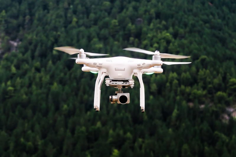
Remote sensing advances to cut costs, increase speed and usher in virtual reality.
New technological tools harnessing the power of remote sensing to make it quicker, easier and cheaper to measure forest inventory will soon be unveiled – and in future could potentially enable a virtual “walk through the forest”.
Researchers are set to brief estate managers and forest planners on the results of a world-leading three-year, $1.8 million collaborative research study jointly funded by Forest & Wood Products Australia (FWPA), forestry companies, universities and government.
The project has delivered:
- methods to map forest canopies using aerial photography that are effective and cost less than other airborne remote sensing techniques or field-based measurements and that can be incorporated into existing workflow systems
- an “app” to count individual trees using 3D point cloud data acquired from airborne remote sensing
- a forest sampling method that can significantly reduce the number of reference plots required to produce a representative model of the variability in a forest stand
- a best practice guide for airborne data collection that will assist the forest industry to achieve efficiency gains from these new remote sensing methods and to integrate dense 3D point cloud data into their operational workflows.
Leader of Forest Science at the NSW Department of Industry – Lands, Dr Christine Stone, says the next step in the research would be to utilise virtual reality technology and remotely acquired 3D point cloud data to enable foresters to visually characterise and measure individual trees.
“It will be like walking through the forest, and you can measure individual trees remotely,” she says. “You’ll be able to electronically select a tree, pick it up, ‘chop’ it in half, tip it up and look at its diameter and put it back down.”
Dr Stone says the quality and quantity of data available is expanding rapidly, with the challenge being its interpretation.
“Five years ago you might have had two data points per square metre, and now you’ve got up to 100 data points per square metre, so much information that you can just about ‘touch’ the trees,” she says. “What we’re doing is using data collected and converting it into something useable – and that’s the hard step.”
Researchers wanted to discover whether timber volume estimates derived from analysis of aerial photography – a science called photogrammetry – were comparable to volume estimates derived from more expensive technology called airborne laser scanning (also referred to as lidar).
“The thing that really surprised us is that the answer is yes. That’s a big breakthrough,” Dr Stone says, adding that it worked very well with radiata and eucalypt plantations.
Managing director of FWPA, Ric Sinclair, says that no single company or institution could have conducted the research alone.
“Collaboration is the key to a thriving and sustainable industry where technology is harnessed to the benefit of all,” he says. “We’re pleased to have played a part in this valuable project, and would like to thank the many members and researchers who participated in the research.”
A research briefing was held in Melbourne on May 11 to demonstrate the tools and technologies developed in the project, with members of the research team holding follow-up meetings for FWPA levy payers who wanted further assistance to incorporate the latest developments.


